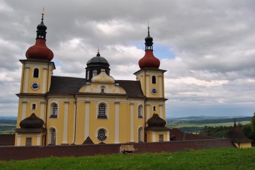
Novohradské hory Nature Park
the Novohradské hory Mountains occupy a total of 162 square kilometres in the Czech Republic, stretching around Nové Hrady, Benešov nad Černou, Dolní Dvořiště and Malont to the state border with Austria, where they almost reach the Danube valley.
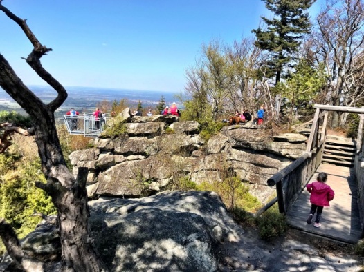
Of the eighteen peaks in the New Hradec Krkonoše Mountains that exceed one thousand metres, three are located in our territory. The largest of them is Kamenec (1,072 m), followed by Myslivna (1,040 m) and Vysoká (1,034 m).
The uniqueness of the Novohradské Hory lies mainly in its rarely preserved nature, spared from human intervention due to its location in the former border zone. In 2000, the Novohradské hory Nature Park was declared here .
Discover a piece of their charm, the diversity and purity of nature and the fascinating history. Almost every step you take you will come across something interesting. Of course, it is impossible to describe all the natural wonders and historical monuments that have been lost in time, or even the important personalities who have lived here. Here are just a few of the highlights. So head to the Novohradské hory and discover for yourself.
The Novohradské hory Nature Park is a vast area of significant natural and aesthetic value, with a harmoniously shaped mountain and foothill landscape. The area is significant for the high degree of preservation of the natural environment, which is shaped by the close-to-nature forest and meadow ecosystems, peat bogs, ponds and springs, as well as the preserved historical values of the area. What is exceptional about the Novohradské hory Mountains is their rarely preserved nature, which has been spared from human intervention thanks to its location in the former border zone.
In the Novohradské hory there are many peat bogs of the upland and transitional type, with an average thickness of 0.5-2.5 m, mostly in small areas and at altitudes of 600-1 100 m above sea level. The largest is Stodůlecká, which covers an area of 30 ha (natural monument, original knees and peat pine). At Černý Údolí, a 20 ha peat bog has been drained and reforested. The others are considerably smaller and their total area is approximately 170 ha.
On foot:
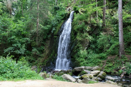
Terčino údolí - a romantic landscape park and national natural monument of 138 ha in the valley of the Stropnice river, located about 1 km from Nové Hrady. The Terčino Valley Nature Trail and the Forestry Nature Trail pass through it. Here you can admire beautiful nature, foreign trees and an artificial waterfall.
Buquoy Landscape Nature Trail - the trail maps the history and architectural and landscape monuments
The New Hradec Králové Border Ponds Nature Trail - a new trail that allows you to visit "hidden ponds"
Falcon's Nest Nature Trail - the trail introduces visitors to the natural attractions of the immediate surroundings of Nové Hrady
Stories of New Hrads Houses - the guide is a book of the same name, which brings the stories of individual houses and streets.
On the bike:
Memories of Novohradsko - a historical and educational trail, physically more demanding, but you will discover the beautiful corners of the Novohradské hory
Memory of the Vitoraz region - Novohradsko, Třeboňsko, Waldviertel - the historical and educational trail includes a Czech and Austrian version, you can turn off the trail several times and return to Nové Hrady, it is suitable for families with children
Memory of the Slepic Mountains - Novohradsko, Doudlebsko, Trhosvinensko - the trail starts and ends in Benešov nad Cerna
Via Verde - the region around the villages of Horní Stropnice and Harbach - an experience trail that invites people to sporting activity and reflection
Swimming
In the summer, visitors can cool off in the waters of Novohrad's ponds, reservoirs and swimming pools. Everyone will appreciate a few tips for swimming during your trips in the Novohrad Mountains.
Pohorje Pond
One of the water reservoirs, the so-called clauses, built to facilitate the navigation of timber on the rivers Černá and Malša and the Pohořský Brook. These were supposedly some of the smallest streams in Europe adapted and used for timber navigation. The Pohořský Pond (also Jiřice Reservoir) was built in the mid-18th century on the stream of the same name. However, the first surviving record of navigation in the area of the forests of Nový Hradské hory dates back to 1783. The village of Pohoří itself was founded around the road to Freistadt in Austria in 1758 and grew rapidly. In 1890 it had a total of 186 houses. The year 1946, however, saw the removal of its German-speaking inhabitants and the demolition of the houses. After 1955 the depopulation continued until it disappeared completely. Today it is being revived, mainly for recreational purposes. The pond is popularly used by passing cyclists and passing tourists for a refreshing swim in the peat-coloured water.
The swimming pool in Horní Stropnice
On the edge of the village, on the Stropnice river, towards Dlouhá Stropnice. Refreshments, campsite. In 2006 it underwent a complete reconstruction.
Humenice Reservoir
Located between the village of Horní Stropnice and Terčina valley.
Veverský rybník
Located near the village of Veveří, south of Nové Hrady.
Zlatá Ktiš
The largest of the eight navigation locks in the Novohradské hory region. It was founded by the Buquoy family at the end of the 18th century on the Švarcava River (today Černá) at an altitude of 766 metres. It was able to hold up to 100,000 cubic metres of water on an area of 5.24 hectares for timber navigation. The construction of the reservoir took place between 1789 and 1796. Around the same time, in 1791, a settlement called Goldentisch was established on the site. It had 11 houses in which up to 130 woodcutters and ploughmen, mostly of German nationality, lived. During a flood in 1794, the dam of the dam broke and was replaced by a new, even more massive dam a year later. It lasted until the millennium flood in August 2002, when it broke a second time. Fortunately, it was rebuilt and improved with a new, safer spillway in 2005. However, the settlement was not reoccupied after the removal of the German inhabitants after 1945 and disappeared. Only a cast-iron cross placed between two chestnut trees on the dyke, a few fruit trees and clusters of golden yellow daffodils, which bloom every spring in the same places as before, have survived.